Exploring the possibilities of high resolution mapping and monitoring
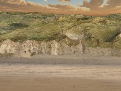
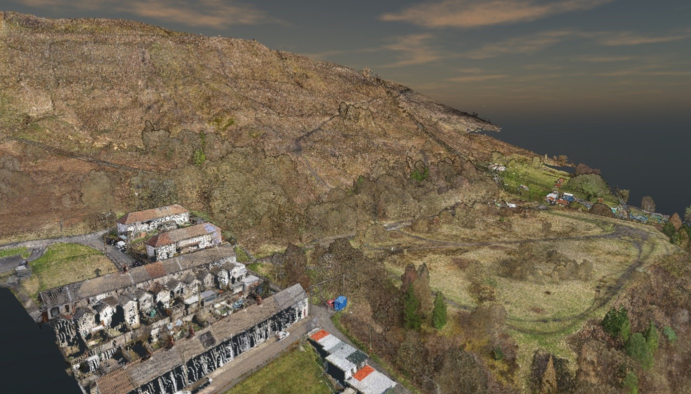
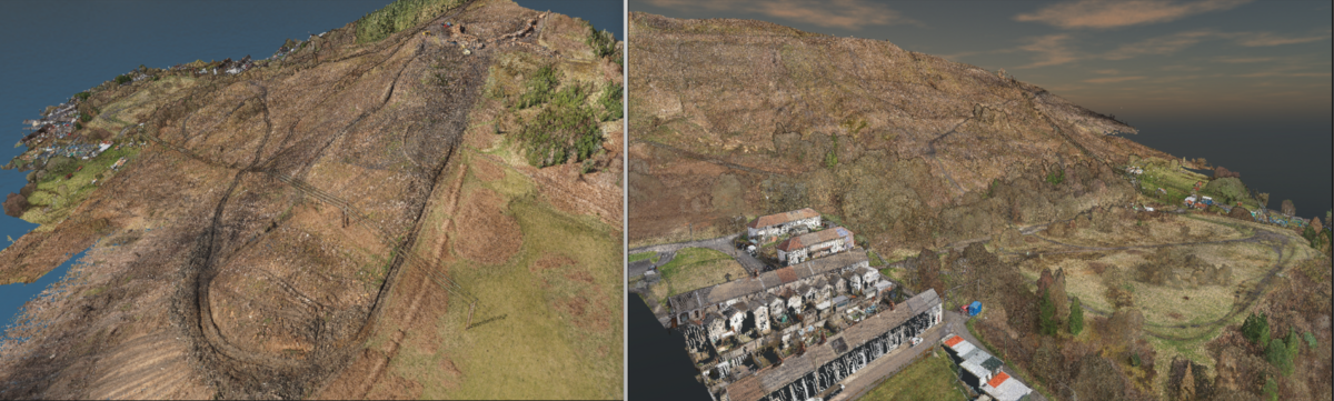
Back in March, we had the opportunity to survey an old coal tip, using our LiDAR drone called George. A landslide risk assessment was required as tree cover had recently been cleared. Therefore, our clients requested a topographical survey of the site. We delivered high resolution 10cm and 25cm Digital Surface Models (DSM), Digital Terrain Models (DTM), and a 5cm orthophoto. The local authorities were also given a colourised and classified point cloud with a point density of over 1000 points/ m2. This was possible by utilising our high end Riegl LiDAR scanner with a better than 20mm RSME accuracy. However, with our data, we can provide much more.
Susceptibility Mapping
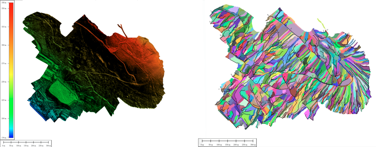
In the UK the largest available landslide susceptibility model has a resolution of 50m. At AG Surveys, we can produce higher resolution local susceptibility models ranging from 25cm to 1m. Using the data collected by the drone, these susceptibility models can be calculated using several different parameters used in landslide susceptibility models that can be derived from the point cloud. These include DEMs, slope intensity maps, curvature maps, drainage catchments and networks, and land cover/usage maps.
Furthermore, the higher resolution elevation models provided by our drone data ensure we can provide detailed landslide/debris-flow propagation models to generate detailed maps of what infrastructure would be at risk of damage.
Continual Monitoring and Post slide Surveys
Using our advanced technology, AG Surveys can provide continual monitoring of high risk landslide areas. By flying an area at regular intervals we can produce a time series of DTMs and point clouds. Comparing difference models between consecutive DTMs can identify deformations in the ground as well as small landslides. Using our high resolution data in a timely manner allows the detection of local deformations. Which help highlight areas of internal movement and water saturation, both early warning signs of impeding risk of landslides. Furthermore, the collection of point clouds over time can be used to re-calculate landslide susceptibility models to assess whether changes in ground/geomorphological conditions have resulted in an increased landslide risk. As a company, we are well suited to performing continual monitoring since we already perform such services for a large construction sites and for coastal monitoring.
On top of regularly scheduled flights, we can collect data in short time frames soon after a landslide occurs. We can use the same DTM difference method described earlier to calculate the volume of ground displaced by the landslide and the size of the landslide scars.
The laser pulse used to capture elevation data can capture both the positional data vegetation and underlying terrain. This is due to the LiDAR laser pulses impressive ability to penetrate through vegetation canopies. Therefore, if a landslide occurs in densely vegetated areas, we can still calculate the volume of ground displaced using differences between DTMs. Furthermore, capturing vegetation properties such as tree height, canopy cover and forest volume allows us to calculate biomass loss post landslide using cloud-cloud comparison techniques as well as biomass weight and retention for ground stabilisation.
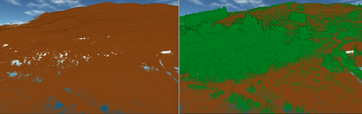
3D view of classified point cloud showing with and without vegetation class points.
In conclusion, this retrospective of the Rhondda coal tip site has provided the company with valuable insight into how we can explore new avenues of surveying for our clients! The advantage of using AG Surveys to conduct these data collection and processing services is that we are experienced aerial UAV surveyors who are confident in collecting and processing point cloud datasets. Additional details about our UAV surveys can be found here and other UAV related projects here