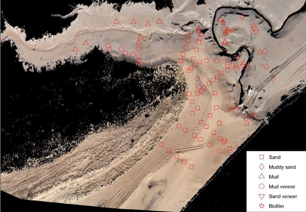
Today saw our last meeting at Swansea University as part of our NERC funded research involvement for the dissemination of surface types in high inter tidal foreshore areas. The University has been looking into the use of UAV to not just capture foreshore data for height models, as we currently do, but to also test automated routines to distinguish between different sediment types, primarily sand and mud and mixes of them. We are proud to have been involved on the technical advice in the use of drones for coastal monitoring and looking forward to part 2 to build and further the developments achieved so far (subject to funding).